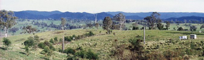
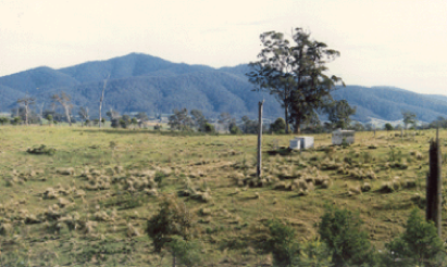
Photos above show the undeveloped site in 1988 (property boundary indicated by a, b and c). Tall eucalypts in mid-ground are E. melliodora and E. tetricornis (Photos: RJC 1988).


Biophysical setting:
Located in the Wandella Valley (Far South Coast, NSW). Altitude is 200m asl and distance from the coast approximately 21km. Latitude and longitude 36°20' S and 149°51' E respectively. Climate of the region is classified as 'temperate with no dry season (warm summer)' (Koeppen Classification).
The site lies near the crest of an EW trending ridge which topographically separates the Wandella Creek and Wallaga Lake catchments. Slopes are very gently to gently inclined (1 to 10%). Bega Granites underly the site with weathered bedrock occasionally encountered on the ground surface. Soils comprise a sandy loam over a clay loam/clay subsoil. The latter is generally encountered at depths of around 30 to 40cm and typically contains rock fragments derived from the decomposing granites. The agricultural capability of the site is Class 4, that is, suitable for grazing rather than cultivation.
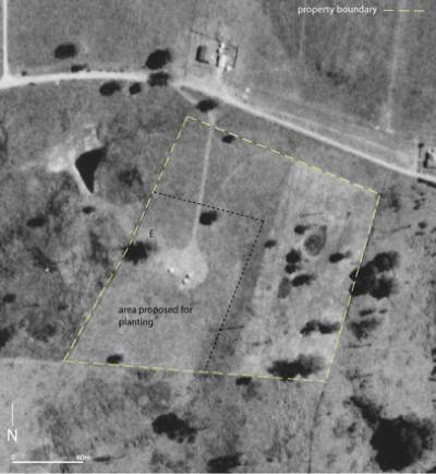
Air-photo left shows site in 1985. Yellow dashed line marks the property boundary (total area 4.22ha). Black dashed line shows the approximate boundary of area proposed for planting. The area outside was reserved for pasture, water storage and bush regeneration. The eucalypts noted above are marked by 'E'.

Design and initial plantings (1989 to 1994)


Green infrastructure, particularly the tree component, has been a long-standing interest. A special long-term project is the Misty Vale arboretum. Starting in 1993, a wide variety of tree species have been planted in various configurations. The following pages show how it has developed.